
Boundary Papers
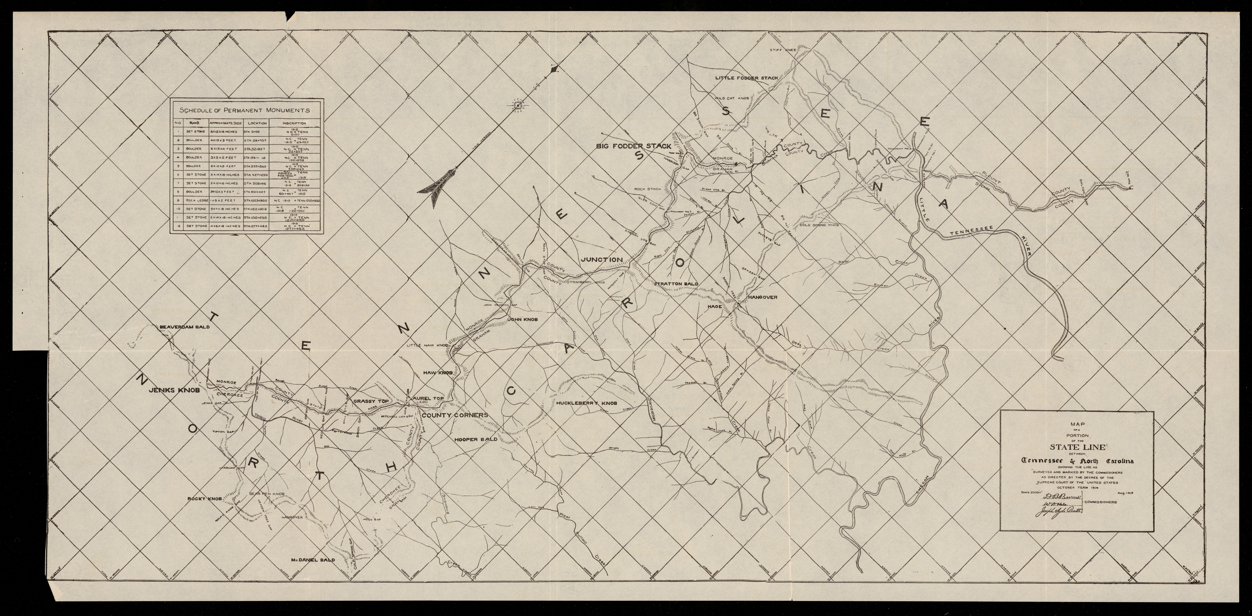
The Boundary Papers collection consists of maps, correspondence, reports, receipts, and other papers relating to North Carolina’s boundary lines with Virginia, Tennessee, Georgia, and South Carolina. The collection also includes records concerning boundary lines between North Carolina counties and townships.
This digital collection contains materials from the Secretary of State record group, which contains land office records that provide additional context for decisions centering on North Carolina’s land use. While the Secretaries of State are prominently featured, the Boundary Papers also include records created by county commissioners, governors, surveyors, civil engineers, and General Assembly representatives who contributed to the creation of the state’s boundaries.
This digital collection spans from 1773 to 1953 and provides insight into the relationships between state governments, the development of North Carolina, and the regulatory and civic reasons why boundaries were contested.
For further information on state boundary lines, see Boundary Line Papers, which includes analog materials from the Secretary of State's papers, the Southern Historical Collection, and other sources. These records, spanning from 1789 to 1994, focus on boundary issues between North Carolina and its neighboring states.
We strive to make North Carolina Digital Collections as accurate as possible. If you find any errors, please contact us at archives.webedit@dncr.nc.gov.
Your search has also found results in related AM products.
Show me the results